Lake Annecy swimming adventure (story + practical info)
Paddling in Lake Annecy could not be easier, but swimming across it takes some preparation. In this article, I tell you about my adventure and propose a rather special map of the lake.
Is swimming a funny idea?
When you travel by car, bike or on foot, you usually know where you’re allowed to go and under what conditions; this is far from being the case for swimming trips. It’s exactly for this reason that I particularly appreciate this mode of transport.
Bodies of water seem to me like new, untamed terrain, right under our noses. A swimming trip is also an exceptional way to feel out of place : you change environment, perspective, and see familiar landscapes in a new light.
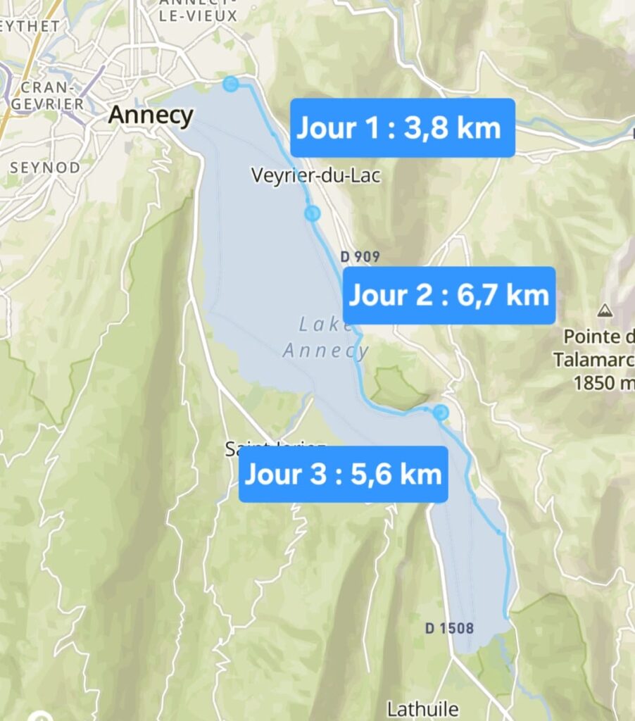
After a successful first swimming trip (click to listen to my podcast) and wanting to discover Lake Annecy, I decided to travel along its shores (you’d need special permission to swim in the middle of the lake). Covering the 14 km length of the lake in three days required real preparation.
Mapping the lake
The Annecy municipality map is useful for knowing where you’re allowed to go, and indicates a few beaches, but that’s about it.
Once you’re in the water, you have to find a place to moor to return to civilization, which can be tricky: in some places, the banks are private, flush with the road or impassable.
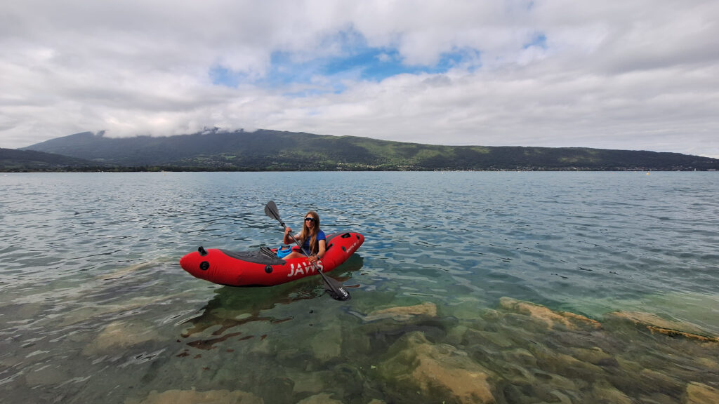
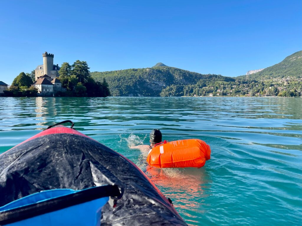
I spend a lot of time studying the map before setting off. To be on the safe side, I’ m accompanied by Nathalie Baillon in her packraft, who will paddle alongside me. It’s reassuring, and above all, she can scout ahead to show me where I can stop.
During my swimming trip, I don’t want to have any nasty surprises when I realize I’ve got to go two kilometers further than planned.
Once there, I’ll also do a bit of reconnaissance by bike along the cycle path that runs alongside the lake. This will allow me to identify a few corners to bypass and a few where I can stop, but between houses or roads blocking the view and spaces not accessible by bike, I won’t be able to foresee everything.
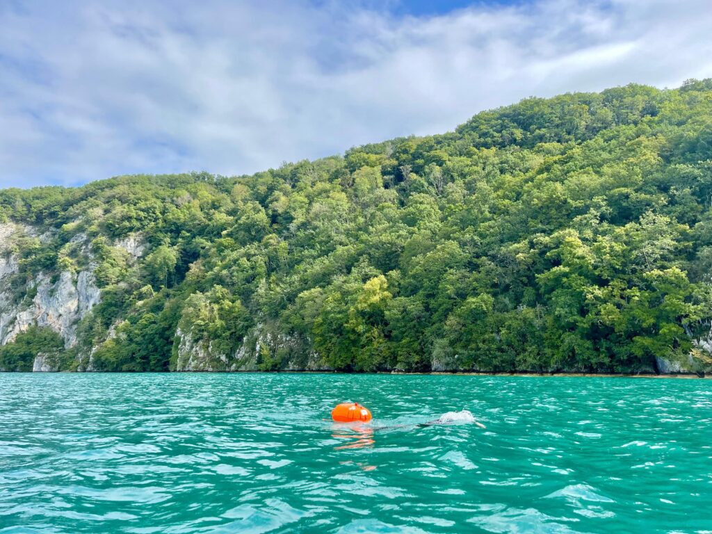
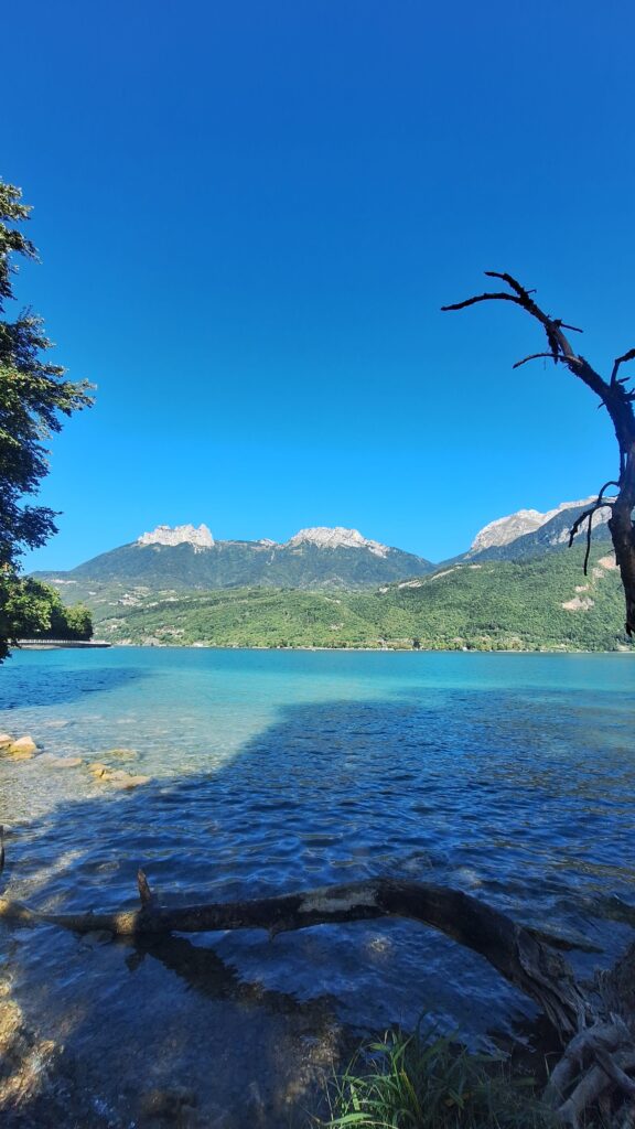
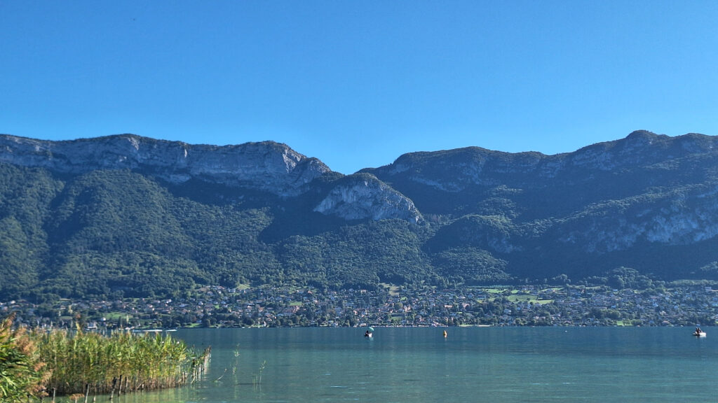
I choose to swim the length of the lake from the east side for several reasons: it stays sunny later in the afternoon, it has more small beaches or public accesses to the lake than the west side; and finally, it boasts the Roc de Chère Nature Reserve, which stretches along just over 3 km of coastline, and offers a breathtaking cliffscape.
Physical preparation and organization
Once I’d decided on my itinerary, all I had to do was prepare my body and equipment.
My physical preparation is limited. I’m in good shape, I’ve been swimming open water for a long time, and I set myself reasonable daily distances for my level: I’ll never swim for more than an hour and a half at a time.
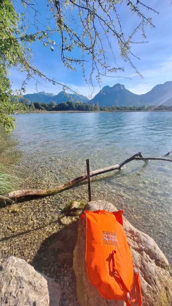
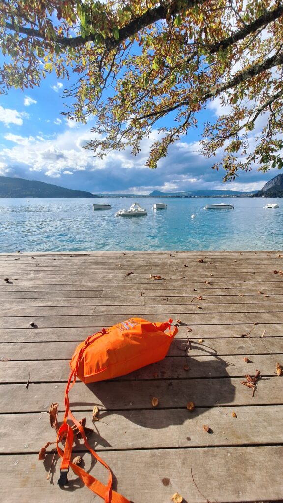
As far as equipment is concerned, I’m going to use my big swimming buoy , which doubles up as a bag for my gear. This way, I’m always visible from a distance, I can hold on to the buoy to float if I get a cramp or drink the cup, and above all, I can change, eat and drink as soon as I get out of the water without depending on anyone else.
I also bring my usual swimming gear: swimsuit, swimming cap, goggles and earplugs.
In September, water temperatures hover around 17 degrees, so I also pack my neoprene gear: wetsuit, gloves and booties.
My equipment for three days of touring swimming:
- Swimsuit
- Swimming goggles
- Swimsuit
- Neoprene gloves and booties
- GPS watch to keep an eye on my progress
- Swim Secure 50L open water buoy and bag
- Camping equipment for sleeping in a van
A day-by-day account of my adventure
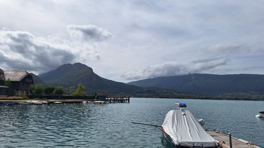
Day 1 – Annecy to Veyrier (3.8 km)
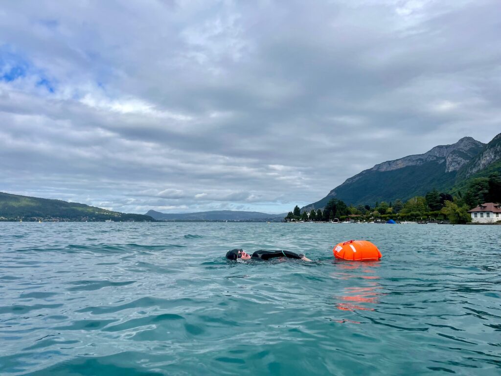
The journey begins in bright sunshine, and I choose not to use my wetsuit, simply covering my extremities with neoprene. Wearing a long wetsuit in full sun would be a risky gamble, as you could cook slowly in it.
The first few meters in the lake are a mixture of joy and apprehension. ” What if I get a cramp? I’ve never had cramp. ” What if the biggest catfish in the world is currently in this lake? ” and so on.
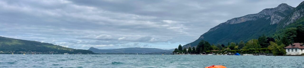
Gliding through the turquoise water, admiring the houses and small fortifications lining the shore, I feel better and better. I no longer look at my watch every two minutes and admire the mountain ridge with every breath. The navigation is very easy: I go from buoy to buoy, at the limit of the swimming strip, which marks the limit of the zone authorized for swimmers and kayaks.
After an hour, I stop and ask Nathalie for a compote to drink. I suck in the contents of the little packet and hand it back to my companion. I feel halfway between an endurance swimmer being refuelled on the fly and a child being offered a snack as she leaves the pool.
In the water, I don’t play at pushing my limits, I always make sure I’m well below them. You have to eat before you’re hungry and get out before you’re cold or tired.
We arrive at Plage de la Brune, where I bask in the sun before changing while watching Nathalie kayak back to Annecy, where she’s left the van that’s been our vehicle and home this week. She seems to be moving very slowly. I see a dark cloud over the town in the distance. The little red kayak disappears as I hear the first clap of thunder and notice that the wind has shifted, acting as a brake against the little inflatable boat.
In the end, Nathalie narrowly avoids the storm and picks me up near the beach.
Now we have to eat, sleep and swim. My life for the next few days.
Day 2 – Veyrier to Talloires (6.7 km)
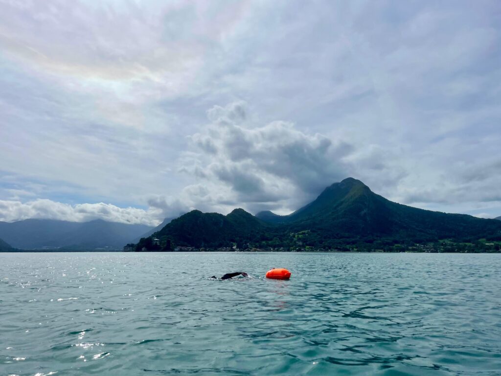
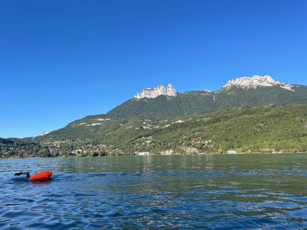
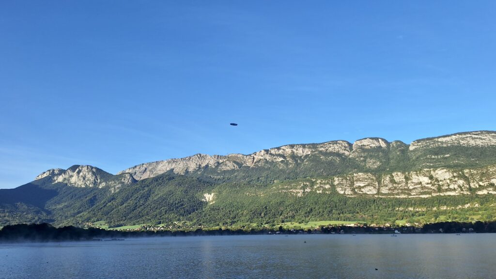
The next morning, a routine is already in place: coffee, briefing, launch. This time, I’m going to swim two three-kilometre lengths, taking a break just before skirting the rocky massif that I suspect offers no opportunity for respite out of the water.
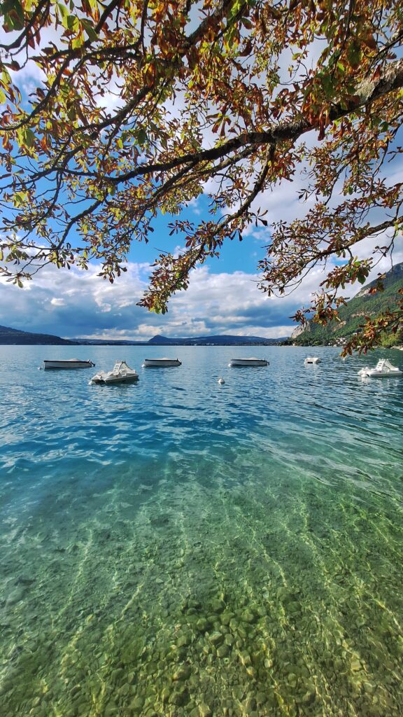
I’m getting used to the experience of long-distance swimming, which requires me to accept solitude and slow movement. I think less and less about my breathing, which spaces itself out every three to five arm movements as I pick up the rhythm, and soon the state of full awareness imposes itself on me: I see a cliffside a hundred times over that makes me feel my slowness. Each time my hand enters the water, I see little air bubbles form on my fingernails, shining like diamonds in the turquoise but perfectly translucent water.
It’s a long way around the cliff, as all the undulations of the pine-covered mountain merge into each other, and I can hardly make out the actual point I have to reach, which marks the last kilometer to go.
Just before Talloires, Nathalie sprints to determine which of the two beaches in sight is private, and therefore to be avoided.
Dinner. Sleeping.
Day 3 – From Talloires to the end of the lake (5.6 km)
The third day is when I reach the reserve at the end of the lake and can say I’ve swum the length of Lake Annecy.
The bright sun threatens my exposed skin despite my two layers of sunscreen. After an hour and a half of swimming that seems to last only a quarter of an hour, I stop more out of duty than desire at a small beach close to the road, where a puny tree offers a little shade.
I’d like to keep going without a break, hypnotized by the rhythm of my breath and the air bubbles, but I know I don’t have the training to cover the 5.6km in one go.
After gobbling up a whole packet of dried bananas, I jump into the water for the final stretch. I have a twinge of guilt when I see the buoys marking the southern tip of the lake. I’m also starting to get a big twinge on the back of my elbow from my lack of training and repeated movements. Time to get out of the water.
Day 4 – Scouting the other shore
I’ve conquered the eastern shore. I’ve only gotone day’s vacation left, which I’m using to map out the rest of the lake, sometimes by bike, sometimes by swim, to get a complete overview.
I’ve now spent four days on Lake Annecy and I wonder who, apart from the sailing-mad locals, can claim to know the area in such detail.
I close this adventure with a complete map and a host of sunny memories.
Conclusion
The journey across the lake gave me an amazing sense of adventure and discovery for such a touristy place. Each section of the lake reveals a different landscape: sheer cliffs, imposing hotels, secret little beaches, picturesque villages…
To discover a place from top to bottom, and to have very precise memories after hours of watching the landscape go by, there’s nothing better than traveling in water, at twice the speed of walking. That’s what I call hyper-smooth mobility.
Practical information on swimming around Lake Annecy
For those who’d like to try their hand at itinerant swimming, or just go for a coffee in the next village and travel by lake, I’ve created a map showing where you can get in and out of the water, and the sections where no exit is possible. It can be used in conjunction with the municipality’s map to set off on an adventure while respecting the rules.
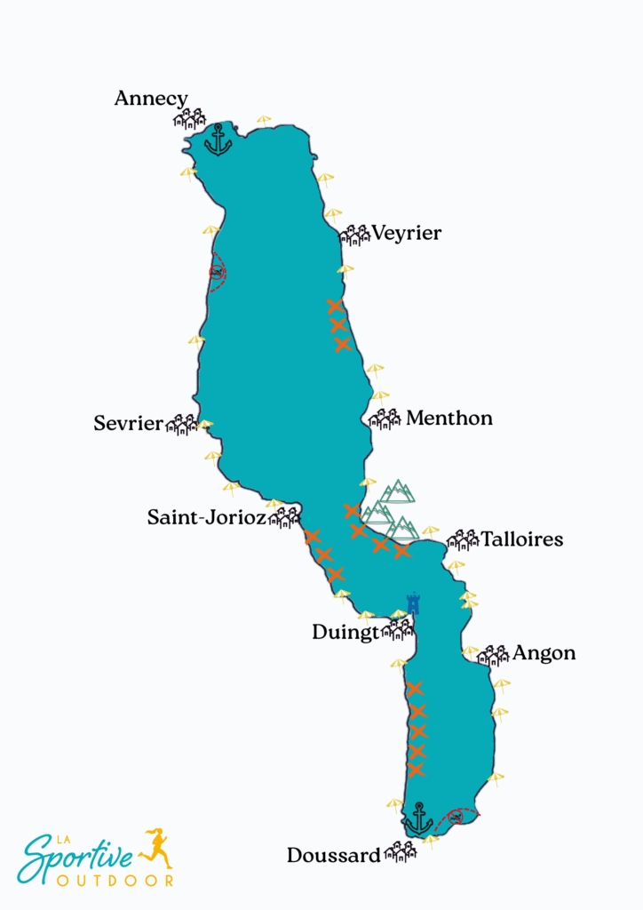
Here you’ll find all the practical information you need for a well-informed swim around the lake. With the exception of the northern and southern ends of the lake, you can swim everywhere, while respecting protected areas and lake regulations.
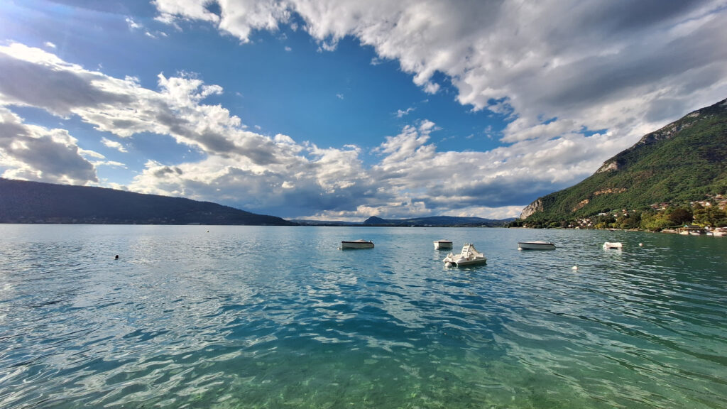
Although you’re not supposed to swim across the harbors, it would be impossible to avoid every tiny pontoon that accommodates small pleasure boats, and the locals swim there quite freely. My map only shows the harbours of Annecy and Doussard, which are large and busy, so should be avoided.
Lake Annecy is very popular in summer. I therefore recommend that you choose the mid-season to swim there safely and without hindering traffic.
From Annecy to Menthon
Departing from Annecy, the possible departure beaches are Albigny on the east side and Les Marquisats on the west side.
If you follow the lake from north to south on the east side, you’ll find beaches or ladders leading out of the water to a public space that runs fairly regularly until you reach the Veyrier exit.
Between the last beach in Veyrier and the first beach in Menthon, you can swim in complete tranquillity, but it’s difficult to find a place to go out or rest, as these banks are private and open directly onto private gardens or pontoons.
From Menthon to the end of the lake
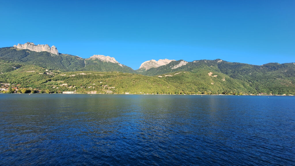
Beyond Menthon, another obstacle rises above the lake: the magnificent Roc de Chère Nature Reserve. On this stretch, there’s no real way to get out of the water and onto land. Instead, you’re faced with a sheer cliff that plunges into the turquoise water.
There are a few opportunities to get out of the water for a short break at the bottom of the rock when a low rock edge or small cave offers the chance, but these accesses depend on the water level, so can’t always be relied on.
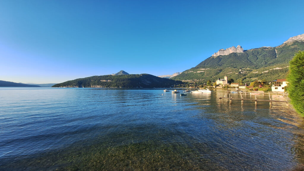
As soon as the cliffs settle, access to the shore appears just before Talloires.
Between Talloires and the end of the lake, there are several small beaches, as well as a number of shallow spots (such as rocks or a gentle slope towards the cycle path) where you can get out of the water or take a break.
Finally, just before you reach the protected area at the end of the lake, a small pontoon and path mark the last place where you can leave the water.
From the protected area to the Château de Duingt
You’ll then have to walk around the end of the lake: the strip of shoreline is divided into a no-swimming zone, a private beach and the port of Doussard.
If you want to sail up the lake from south to north along the west coast, you’ll need to get in the water as soon as you leave the port of Doussard, as the length of the lake is then marked by a wall crowned with a barrier along the main road to the village of Bredannaz.
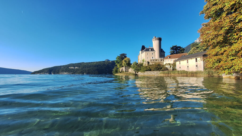
From Bredannaz to Château de Duingt, opportunities are once again few and far between, and the main road hugs the lake as closely as possible. You’ll have to swim around the château to find the next beach, called Plage du Château. The Château is private and open only for events, so swimming around it is a great opportunity to see it up close.
My must-have tip
While it’s essential to be well-informed about the area before embarking on a swimming adventure, the most important thing is not to test your limits in unfamiliar territory.
In the water, you can ‘t just sit back and relax like on a hike; you’re always on the move.
I therefore recommend planning ahead in terms of time and distance!
From the château to Annecy
After the château, an almost uninterrupted reedbed begins as far as Saint-Jorioz. You can swim around it, but you can’t disembark. This is the longest reedbed on the lake; the others are sufficiently segmented that you can land at regular intervals between protected areas.
From Saint-Jorioz to Annecy, beaches, small harbors and reed beds alternate, offering multiple possibilities for getting out of the water.
Please note that a jet ski zone is the second area of the lake where swimming is prohibited, but only if jet skis are present at the same time. However, you can easily get around it on foot by taking the greenway that runs alongside the lake at this point.
The Marquisats beach marks the northernmost point beyond which it will no longer be possible to walk legally along the lake.